Line Maps – These show where streetcar (and later bus) lines ran
-
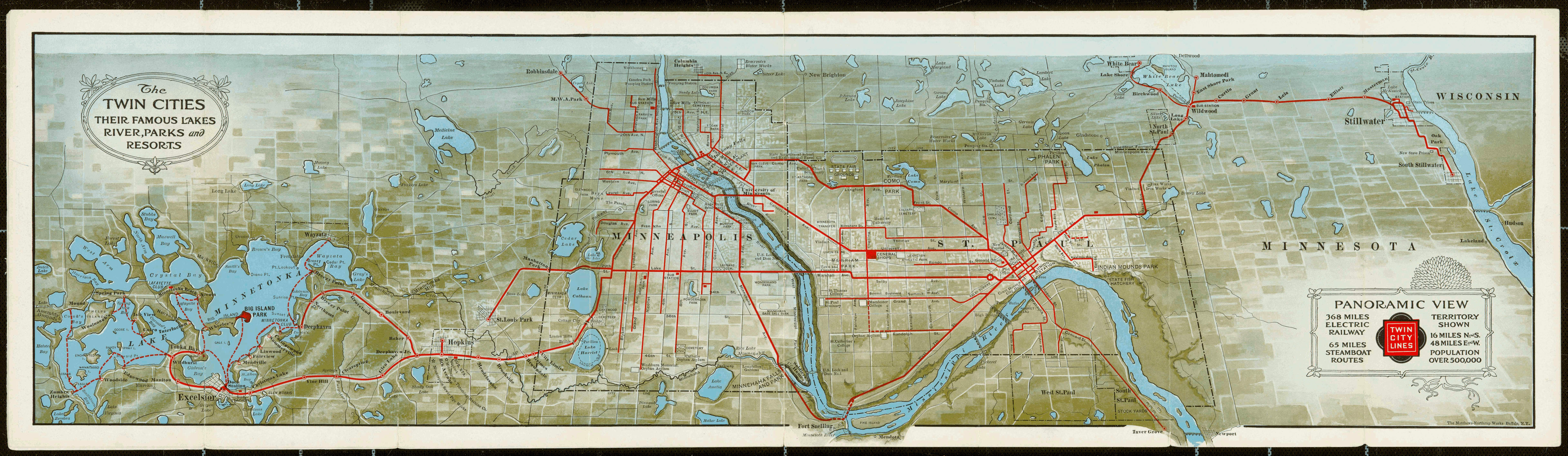
- 1909 Twin City Rapid Transit Color Line Map
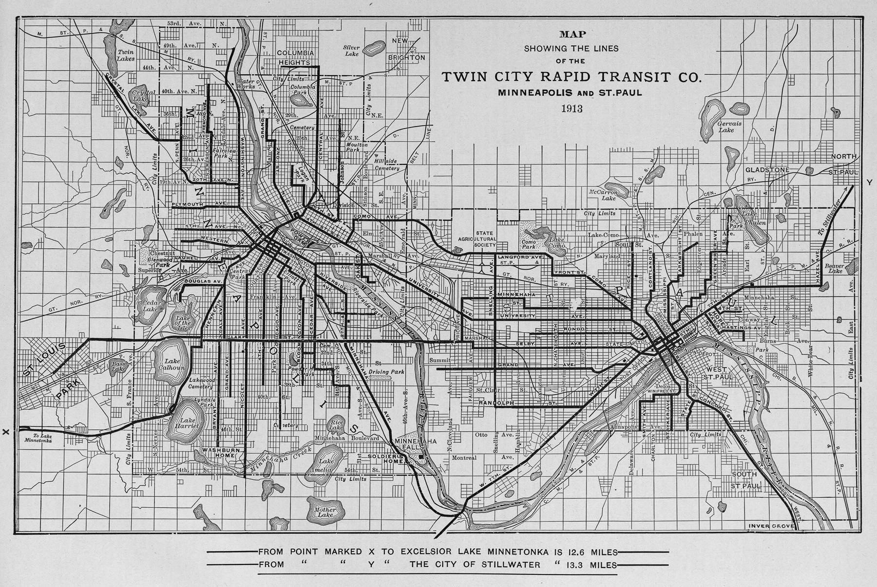
- 1913 Twin City Rapid Transit Line Map
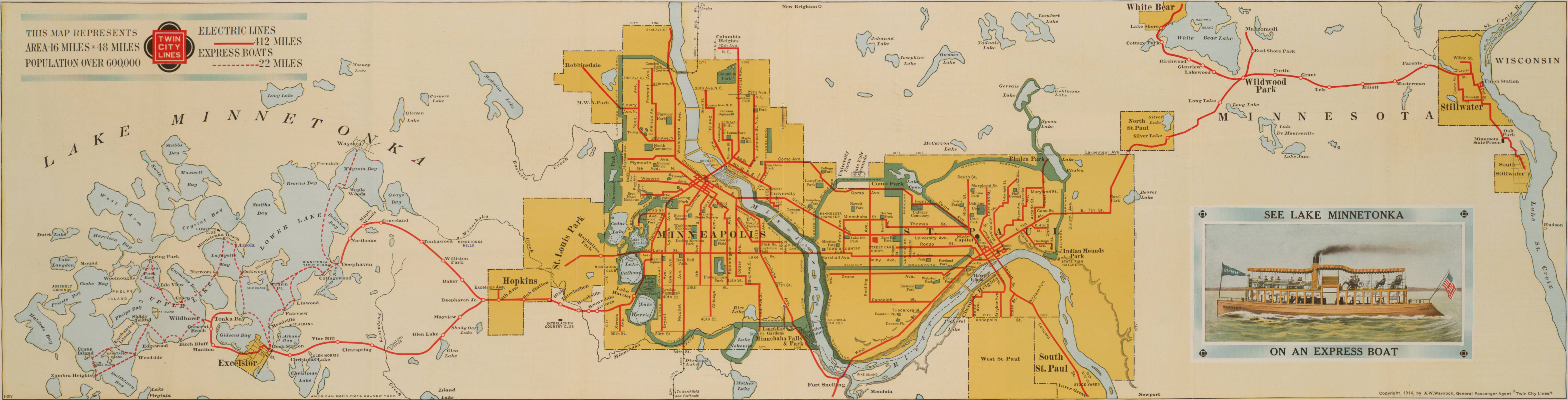
- 1914 Twin City Rapid Transit Color Line Map
- 1933 Color map of Twin City streetcar lines (pdf) – click here
- 1946 map of Minneapolis streetcar lines (pdf) – click here
- 1947 map of St. Paul streetcar lines (pdf) – click here
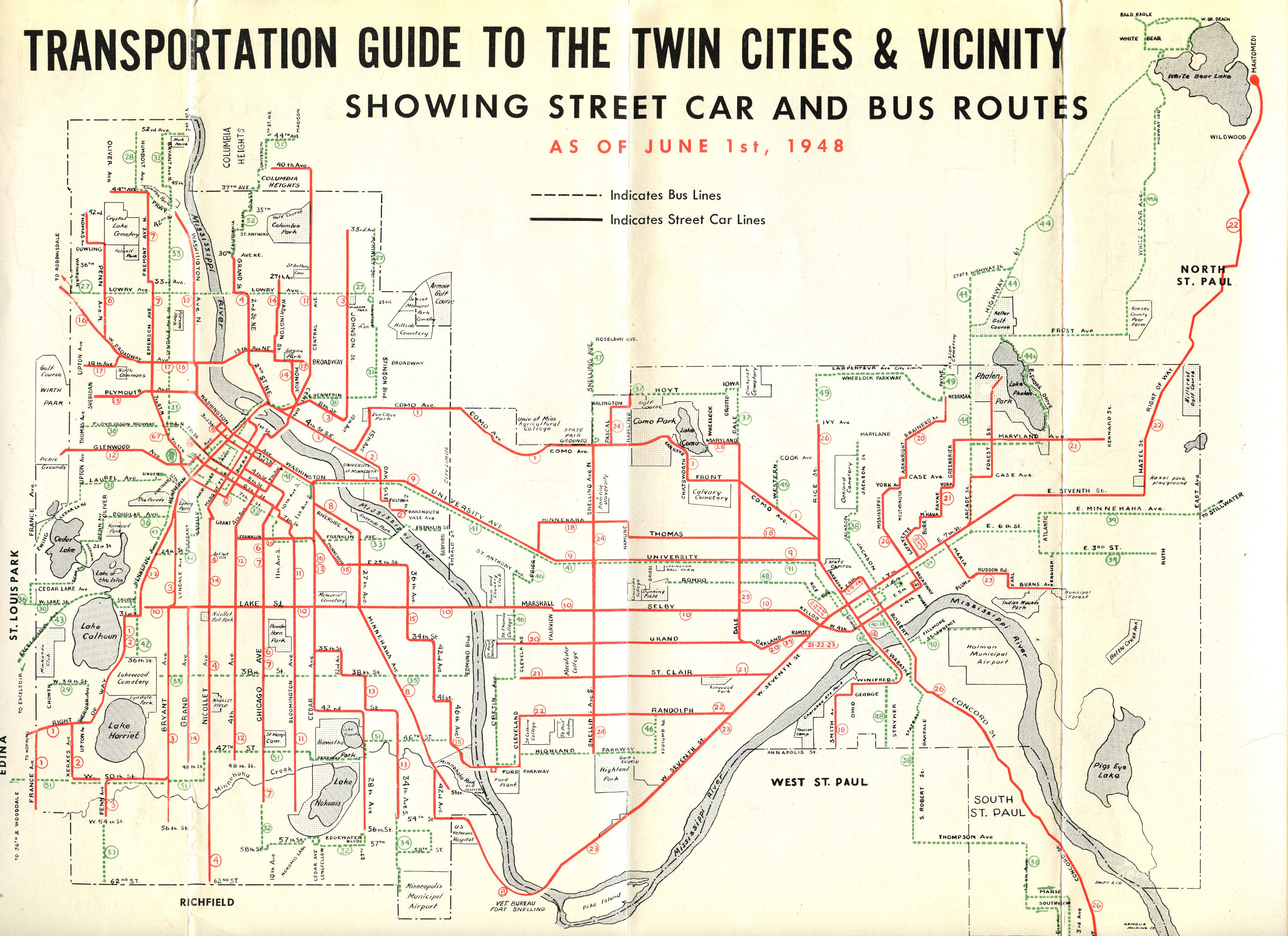
- 1948 Twin City Rapid Transit Bus & Streetcar Line Map
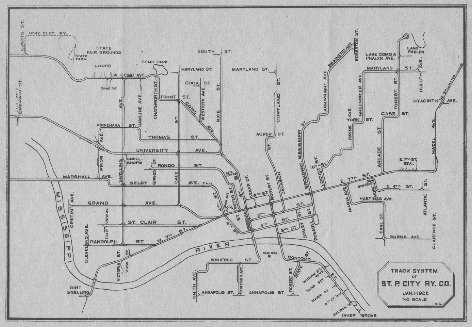
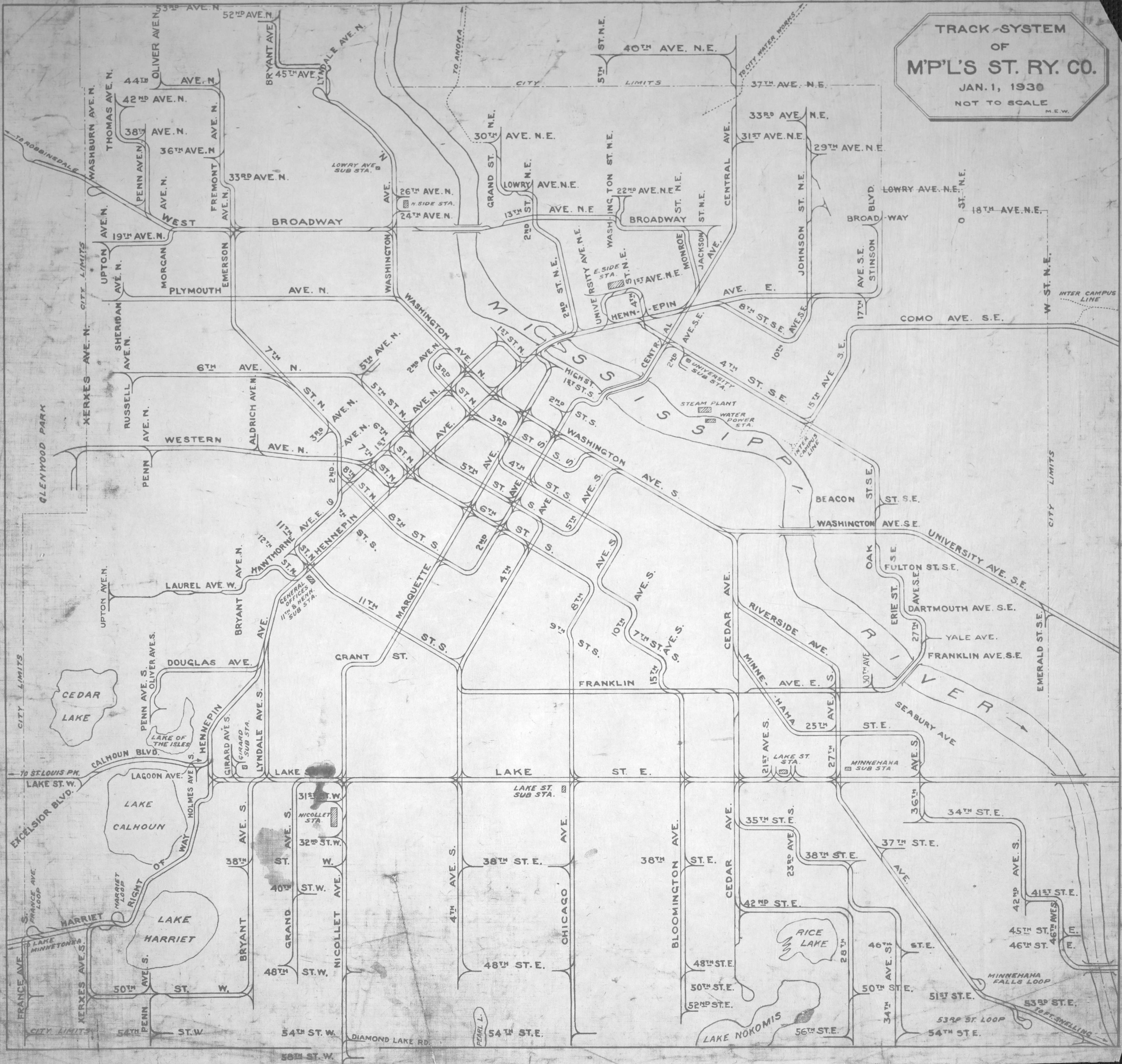
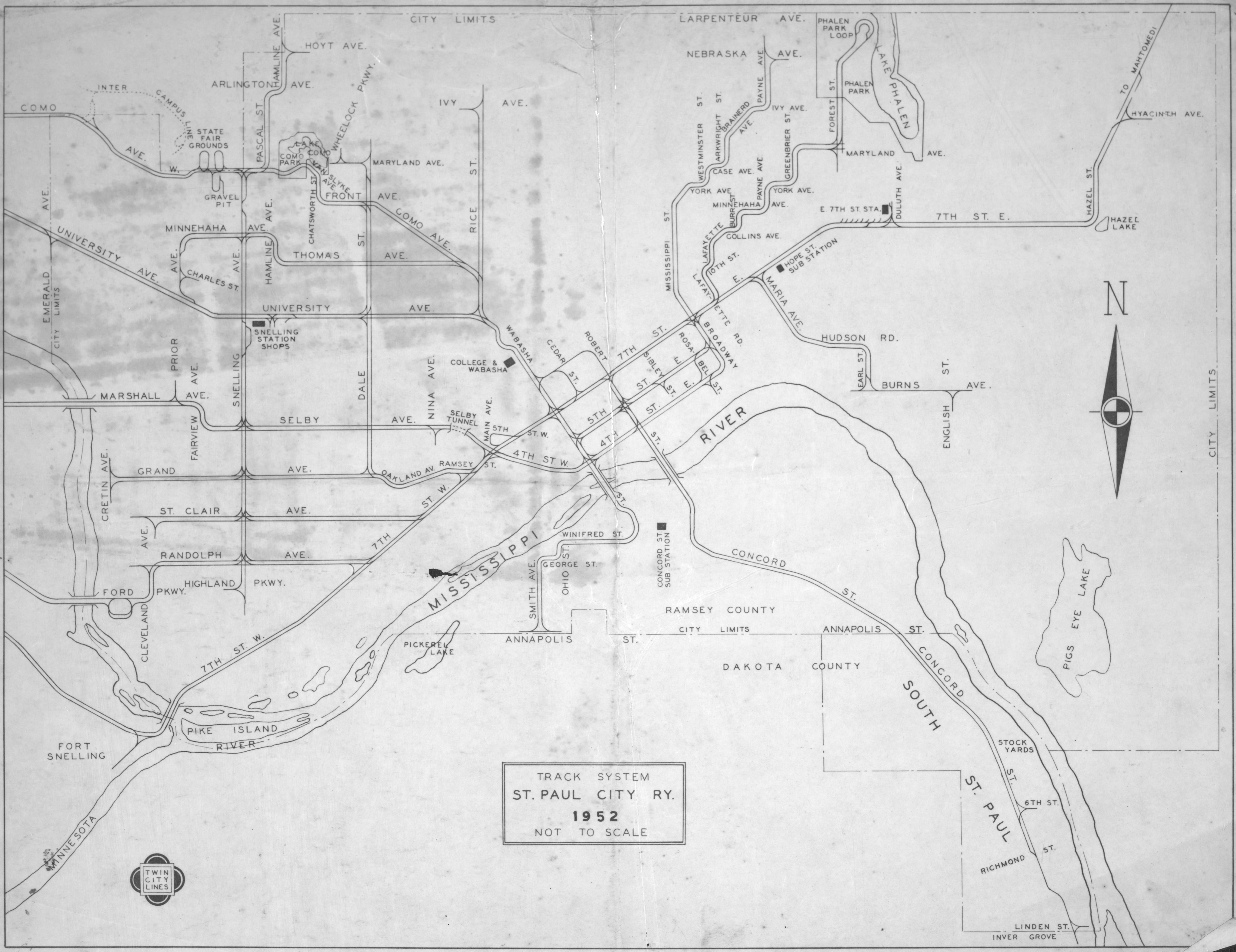
Track Maps – These more detailed maps show things like single and double track, loops, and “wyes”
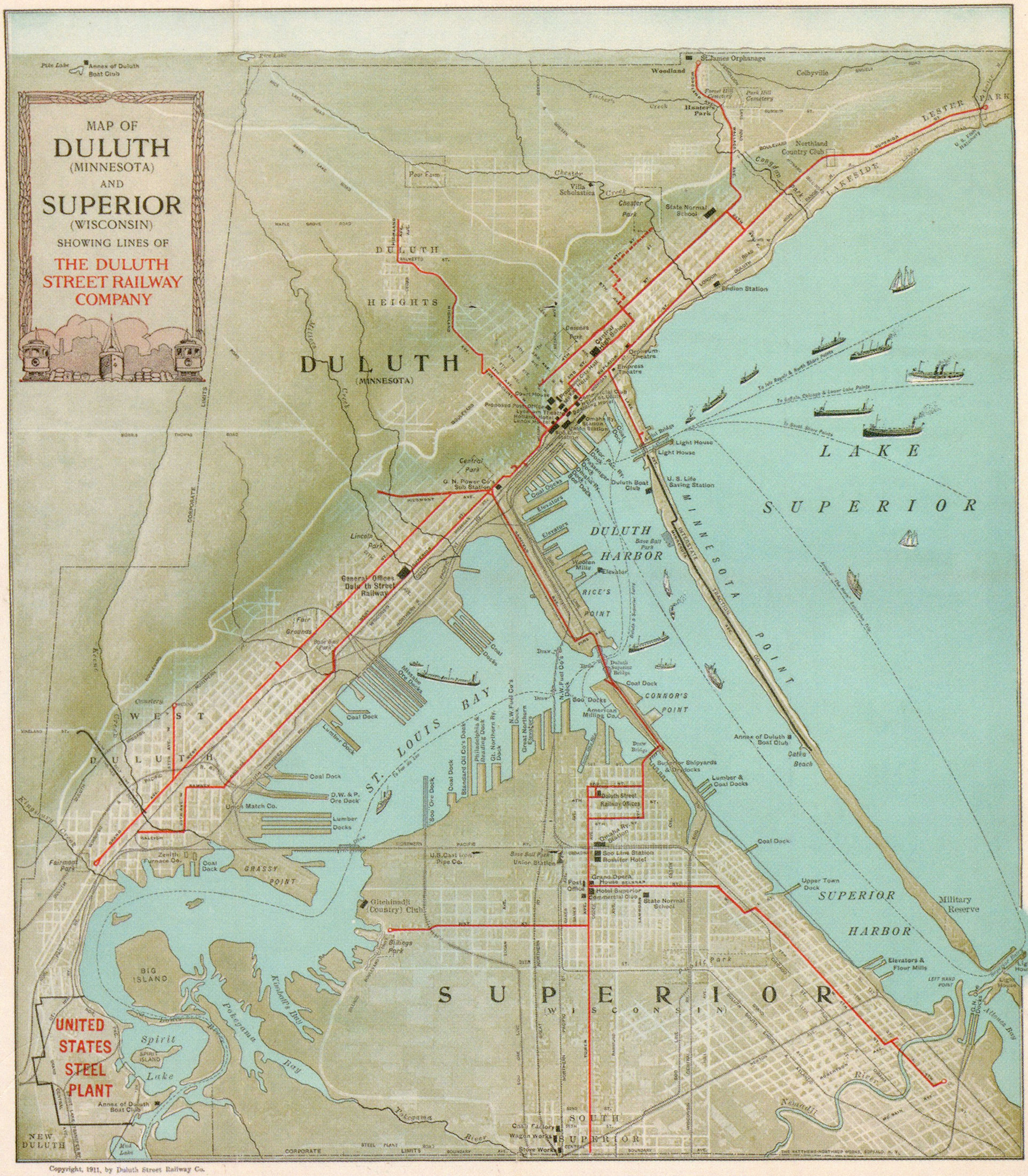
Outstate System Maps
Line Detail Maps – These maps show details of specific lines
Other Map Sources
Check our publications and books page in the historic resources section of the site for publications which contain many additional detailed maps. In particular there are a lot of maps in the Electric Railways of Minnesota book.